.png)
The Indigenous Peoples Atlas of Canada Map: An interactive learning journey
May 7, 2026 News Story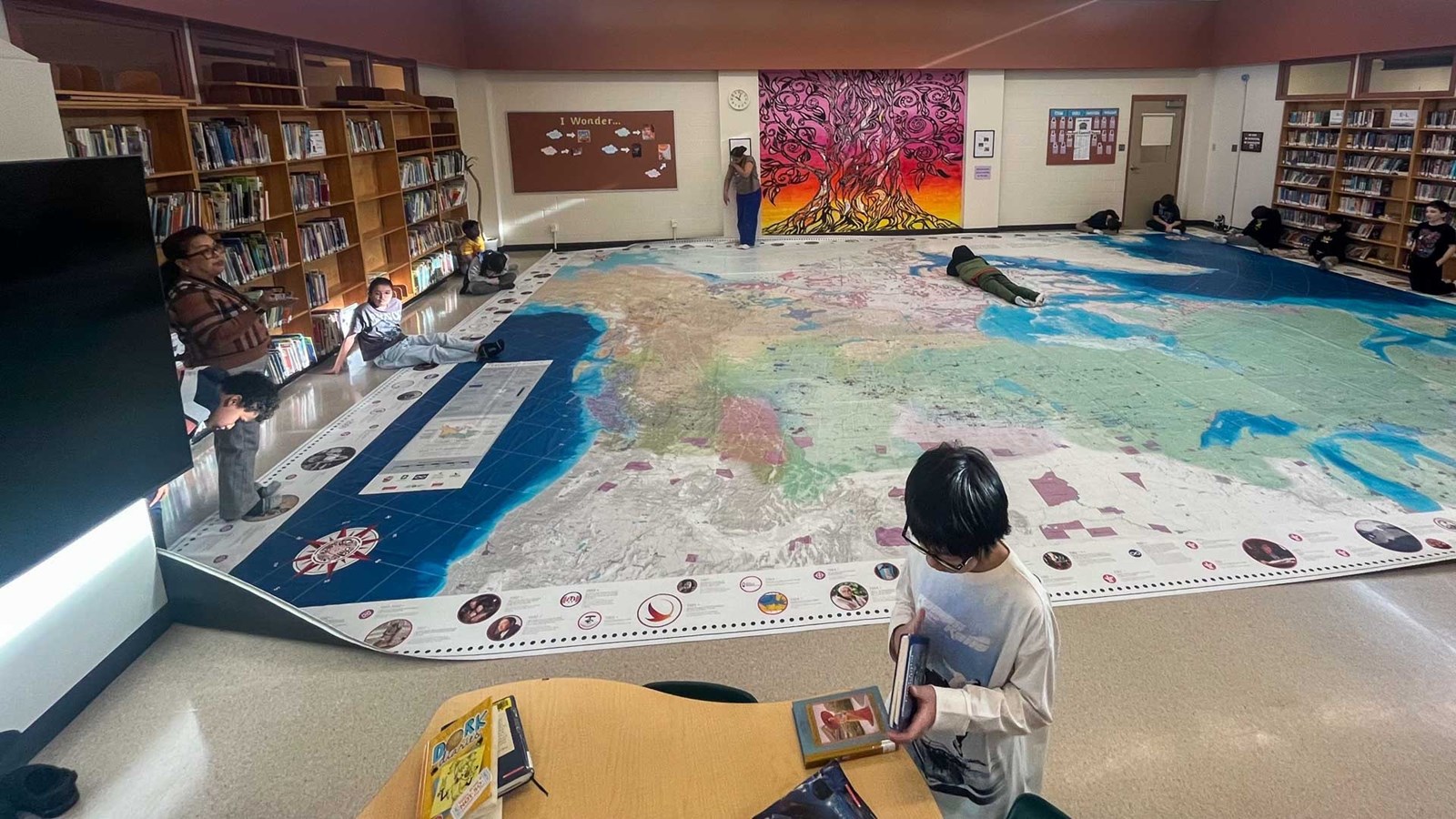
Engaging classroom resources can bring history to life, helping learners connect and rethink complex ideas. At Lord Selkirk School, students recently had the chance to explore the Indigenous Peoples Atlas of Canada (IPAC) Giant Floor Map, walking across regions of Turtle Island, tracing timelines, and connecting the past to the present. Beyond serving as a teaching tool, the IPAC map is a shared space for discovery, reflection, and conversation.

More than just a map
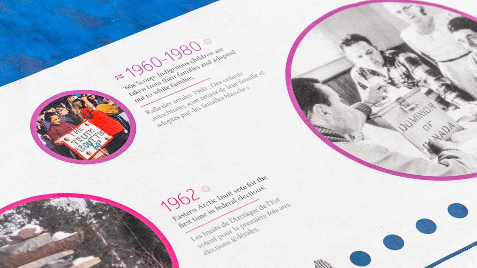
The giant floor map is 8 x 11 metres and took over the library space at Lord Selkirk School. It marks Indigenous communities around Canada and teaches on topics such as residential schools, reserves, languages, and historical timelines. Created by the Royal Canadian Geographical Society, in partnership with Indigenous organizations, it brings layered histories together in one place.
 Its design transforms learning into an interactive experience, as students can physically move across the map, trace timelines, locate places they are studying, and engage in lessons about land, identity, and history.

Learning Across Classrooms
Learning with the map looks different in each grade level. In Grade 6, teacher Lannea Miller used the map to support both social studies and Indigenous education. Students began by comparing it to a standard map, quickly noticing how Indigenous languages, places, and stories were represented.
“It was a nice way to open up their eyes to all the stories that make up Canada,” she shared. The experience also sparked inquiry as students connected geography to ecosystems and began asking deeper questions about treaties, land, and responsibility.
Similarly, in Mary J. Napolitano’s Grade 5/6 class, the map extended ongoing learning. “I had students walk around and find dates or events that connected to what we were learning,” she explained, “and they discovered many interesting facts.”
Max, one of her Grade 5 students, says “it was a great experience to see the timeline of different events”. Olivia, in Grade 6, reflected on discussions these activities brought, concluding, “people need to treat everyone’s culture and traditions equally.” As Napolitano observed, these moments help students move beyond facts toward deeper understanding.
The map also opened opportunities for collaboration. Grade 2 teacher Corey Jhagru linked lessons on treaties to discussions about water and how it connects communities, helping students understand relationships between land and people. They would later build on this knowledge through a collaboration activity with older students from nearby Argyle High School.
Storytelling as a learning tool
The collaboration involved a group of Argyle students who visited Lord Selkirk as part of their Big Picture Learning (BPL) curriculum. The Grade 10 students created animal-based stories and presented them to the Grade 2, using the map as a visual aid. As students moved across the map, they traced their characters’ journeys, helping younger students follow along while strengthening their understanding of geography and place.
 Carmella S., who wrote about beavers, appreciated how younger students learned from her stories, noting their curiosity as they asked questions about lakes and habitats.
“The bear from my story started off in Yukon and went all the way to Lake Superior in Ontario,” shared Josiah R. another Grade 10 student, who used the map to show kids where his bear was travelling to.
Keith Fulford, teacher at Argyle, highlighted the broader impact of this collaboration, explaining that the experience helps “build connections within our community” while supporting his Grade 10 students in developing confidence and leadership skills.

A Lasting Impact
All these learning experiences centred about the IPAC map allowed a deeper level of understanding of complex subjects. Lord Selkirk Learning Support Teacher Carleen Lewicki noted how it supported a wide range of learning across grade levels, and helped students recognize their place within these stories.
Early years students explored language and connected it to lessons on diversity, while Grades 2 and 3 examined significant places and how they change over time. Older students used the map to build skills in direction and historical understanding.
Grade 6 student Olivia encouraged students who use the map in the future to “not just look at it because it’s cool, but to actually take the time to learn from it.” The map, which travels to different WSD schools throughout the school year, encourages curiosity, respect, and a deeper understanding of Indigenous perspectives.